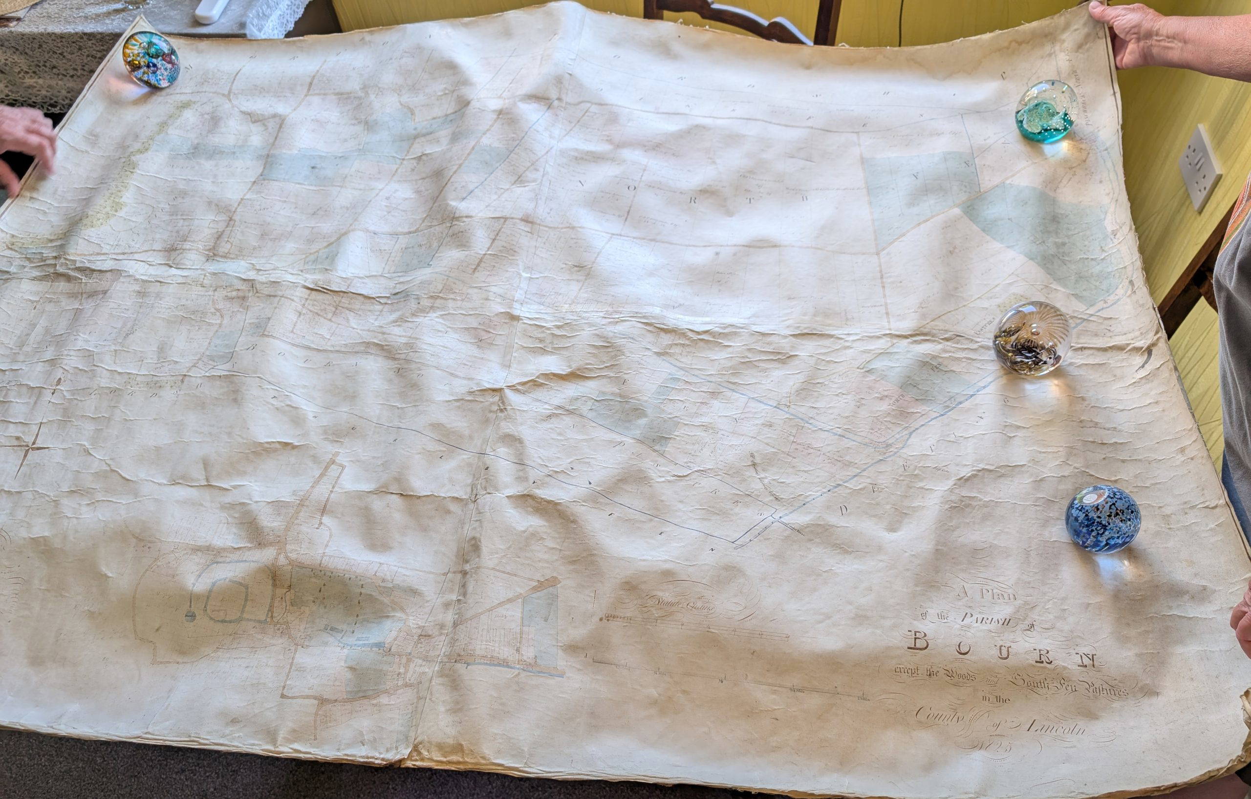
Bourne Town Tithe Map of 1825
Never let it be said that The Aveland History Group are not up for a challenge!
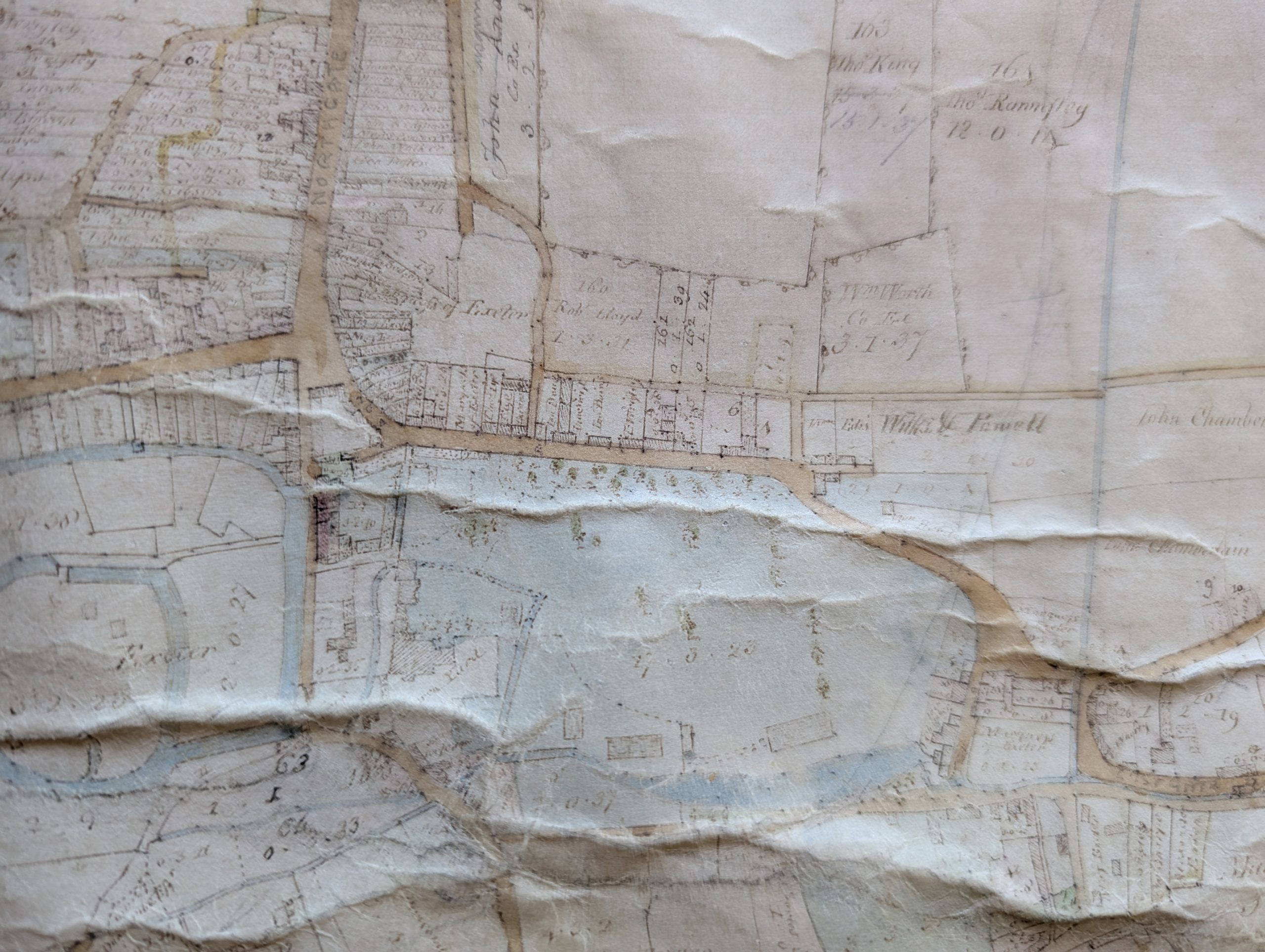
In the autumn of 2025, an approach was made to us by a Bourne resident whose late husband had been entrusted with a unique document – a tithe map dating from 1825 (coincidentally the year Charles Frederick Worth was born) showing the town of Bourne, with the landholders of each and every house and plot of land. The map is around 3’9” deep by 5’ wide – so an impressive handwritten document.
The map is drawn on parchment and had been fixed to a fine linen backing at some point in its history, presumably to strengthen it. Sadly, this had not helped the map and the surface of the parchment was puckered and had deep ridges along it, from being stored in a roll. Everyone who saw it, recognised that it gives an important insight into the town and of course, we all want to conserve it – but how to do this and where to start?
Happily Alison Carr has a seasonal job at nearby Burghley House and last November, was delighted to meet the conservator who has worked on papers and documents in the House Collection, Louise Drover. Alison was able to take the map along to an event at which Louise was speaking and gain her expert opinion on whether the map could be conserved and cleaned. Louise confirmed that work could be done and would be well worth doing, to preserve such a significant piece for the town.
The Aveland History Group then set about putting together quotes for the work and a detailed plan of what could and should be done, including not only the conservation work, but also a digital scan of the cleaned document and a frame for the piece. Quotes came in from various quarters and we had a clear idea of the budget by late January 2026.
We began looking at fundraising and were thrilled at an event with Bourne U3A when members got behind the project and pledged funding towards the work. However the biggest obstacle, was where should the conserved piece be displayed where townspeople could view it?
By approaching Bourne Town Council with the project, we were delighted that Cllr Brough took the baton and ran with it, approaching a wide variety of possible groups to see where it might be able to be put on display. BTC had also agreed to contribute to the conservation work and found other funders willing to support the project.
By August, there were a team of funding bodies, Bourne United Charities, Elsea Park Trust and The Len Pick Trust were all willing partners with BTC and the public who had pledged their support. All who have contributed to this precious work will be acknowledged when the map returns to Bourne for display.
The Red Hall in Bourne has offered space to display the map once it is restored. Bourne United Charities, who manage the Red Hall will be custodians for the map and it can be visited by the public during the usual working days of the team at that location.
I am delighted to share that the map was safely delivered to Northampton earlier in October by Ali Ray and Alison Carr. Louise will detach the parchment from the linen backing, as this has caused the most damage that has caused the deep wrinkles and cracking of the document. She will clean the parchment surface and so is confident that this will bring more definition to the writing. Though we all agreed, in some areas where there are burbage plots that have the most minute writing, we will most likely need a strong magnifier glass to read the details. The map is definitely in good hands.
Watch out for more updates, as the map is conserved and mounted, then transported to the company selected to make a digital copy for us. The map will then go to a framer, before being returned to Bourne for display, we hope early in 2027.